Cold, damp Monday...Good news!
Well it rained from Sunday afternoon through this morning as expected. Most locations saw 0.50" to 1:00" of rain. Now it is just cloudy, cold, and damp outside. Temperatures are in the low 40's in most locations and it wont warm up much more due to the cloud cover, north and northwest wind, and drizzly weather.


With calm winds, and clearing skies overnight, many locations will near or dip below the freezing mark. This wont be a hard, killer freeze, but some front is possible by tomorrow morning. In response to this the NWS has issued a Frost Advisory from areas around Kansas City southward. You can see the advisory in blue on the map below:


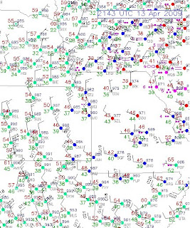
Lets take a look at the current surface map below:

We are gett that north to northwest wind on the backside of the storm system. This is wrapping in some cold drizzle and showers. Take a look at the current radar image:

These showers will likley continue this evening, but will end overnight as skies begin to clear.

With calm winds, and clearing skies overnight, many locations will near or dip below the freezing mark. This wont be a hard, killer freeze, but some front is possible by tomorrow morning. In response to this the NWS has issued a Frost Advisory from areas around Kansas City southward. You can see the advisory in blue on the map below:

The good news is that once we get this cold day by us, abundant sunshine will return tomorrow and highs should warm into the upper 50's and low 60's. Actually highs will be very nice from Tuesday through Friday.

Look at the 500 mb map for Wednesday above. This is about 18,000 feet, or the middle layer of the atmosphere. We will be entering a ridging effect between two troughs. This will allow temperatures to warm up nicely. Wednesday through Firday all have potential to break 70 degrees in many locations. But the day I think it will be in the 70's in most locations is Thursday.
This great weather if you are waiting for morel mushrooms to begin popping. After all the recent wet weather, now we will get a 3, possibly 4 day break with highs in the 60's and 70's and lows in the 40's and 50's before another very slow moving storm enters the picture around Friday night and Saturday.
This next storm may have some thunderstorms, but it looks like severe weather is once again unlikely. Atlanta Georgia had an interesting weather phenomina this morning called a "Wake Low" It caused a 2 hour winds storm with 50 to 60+ mph winds that knocked out power in 220,000 households in Atlanta and 250,000 in Georgia.
I will dicuss the Wake Low later tonight and talk about the next storm this weekend.
Alex Pickman
posted by AlexPickman at
5:01 PM
![]()


0 Comments:
Post a Comment
Subscribe to Post Comments [Atom]
<< Home